Showing posts with label Transit Integration. Show all posts

Wednesday, February 16, 2011

Lawrenceville Greenway Circulator

First,
Slow Clap to the Mayor, and URA for this plan.  It’s a great start to making the city more dense with development once again (and green development at that).  This new green development conjures images of Portland and other urban oases. 


As with any re-development plan (unless you’re a sprawling city) the key is to integrate transit options other than automobile based to increase mobility into and out of your new development.*

This newest plan for Pittsburgh’s new riverfront development certainly addresses these issues.  AVR’s branch to 26st street in the Strip has been planned for integration into the development as part of their already proposed commuter rail and also includes an at-grade “trolley circulator” which would traverse Smallman St.  and Penn Ave.

I’ve talked ad-nauseum about AVR’s commuter line (although I will address the addition of another commuter line later).   As a result I’ll focus more on the at-grade trolley topic as well as an oft ignored topic here in Pittsburgh; the water taxi. 

Trolley Circulator

In my mind, you wouldn’t have to do anything to the strip and it would already be a great idea for a tourist centered trolley.  An at grade line on Smallman St. from saaaayyyy the Heinz History Center to the 31st St. Bridge would be great to move people in the Strip on weekends. 

As such it only makes sense that this idea would be incorporated into this riverfront plan.  As written in the proposal, this line would start at the David Lawrence Convention Center and travel at grade up Smallman St. to the 40th St. Bridge, where it would then loop onto Penn Ave back to approx 21st St. where it would rejoin the ROW on Smallman back to the David Lawrence Convention Center. 

As I said before; solid idea.  I also realize that this is just a proposal for the entire project and as such doesn’t go into too much detail on the transportation aspects of it.  However, there are some issues that should be discussed and ironed out.  

First, check out this great primer for streetcar systems over at the Transport Politic.  

There have been a number of streetcar systems established in the U.S. within the past ten years.  What’s even more promising is that some of these have built a successful nitch in traditionally non-transit friendly areas, such as Tampa’s TECO Streetcar and Little Rock’s River Rail. 

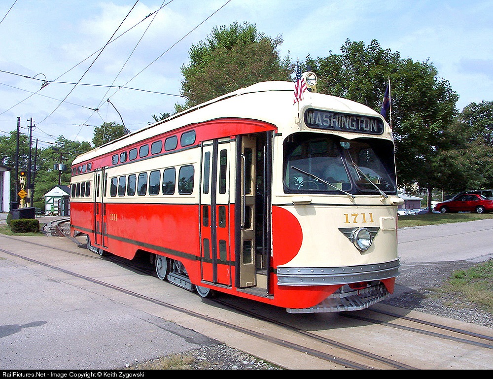
These and other systems have capitalized on the nostalgia aspect of trolleys.  Many lines use either heritage equipment (like San Francisco’s fleet of PCC cars) or new equipment made to look old (like TECO and Little Rock).  It would bring back a lot of memories for Pittsburghers to see trolleys like this


 or this


There is certainly something to be said for marketing your operation correctly and nostalgia is certainly a good way to do it.  However, nothing beats ease of use and good inter-connection.  I like the idea that it spans the entire length of the Strip from downtown all the way to Lawrenceville.  It would be a great way for a Lawrenceville or Strip resident to get downtown or move between the neighborhoods.  

However, the key question which isn’t really addressed here is;  how do you get to the trolley if you’re not one of these residents?  What are it’s connections?  I know there is talk of another trolley circulator to Oakland but that’s a topic for later.  How will someone from the Southside, or the South Hills make use of this trolley without driving to a parking lot in the Strip or Lawrenceville?   The T would make a great connector, but with AVR seemingly going all the way Steel Plaza, that takes away that option. 

Additionally how will someone from Oakland, or Hazelwood, or East Liberty or Garfield get to this line without driving?

 It can be done, after all we’ve got the East Busway for the east end neighborhoods, and supposedly this commuter rail will be an option for people coming from the South, but how this will be integrated and implemented are important discussions that could make or break this operation. 

Lastly, I don't like the idea of putting it on Penn Ave.  I know the plan is to use the circulator to take cars off the streets, in particular Penn Ave. in the Strip.   As a transit guy, I know I’m supposed to believe that putting down rails will take cars off the roads, and I DO believe that.  However, I’m a realist and know a lot of people drive to the Strip on the weekends and that a lot of people will continue to do that as a lot of them are NOT city residents but in fact suburbanites.  I also know that it’s basically bumper to bumper traffic from about 25th St. down through 16th on a Saturday morning.  I think over time that will change but the change will not be immediate.  I think you can get nearly the same effect by putting two tracks in Smallman St. and letting Penn Ave alone.  That said:  it’s not a stake in the heart of the idea. 

The second issue is more of a practical nature.  If you have one track on Smallman and one on Penn, you are creating two at grade crossings of the AVR’s commuter line should it follow its proposed route on 26th St.  Two rail operations crossing at grade are more complex than a road crossing a railroad at grade.  It involves more circuitry, and electronic systems to accomplish.  Why do it twice within a few blocks, making redundant systems when you can do it once, on Smallman St?  You’re not chasing passengers away by having the route one block away with the relatively narrow blocks in the Strip, and you’re saving money on implementation and operating costs. 

Overall, I'm clearly on board with this.  I think it's a great idea and the Strip is a great place to do it.  However, there are some issues that will have to be fleshed out before this aspect of the Riverfront plan could be implemented.  


I was going to cover the additional circulator to Oakland in this post, but seems as though I am rambling and will probably cover that and the “proposed” North Hills to Hazelwood commuter line at the same time. 

Next up:  Water Taxi


*As an aside, that was a major failure with earlier re-development projects in the Pittsburgh area.  The water front is nothing more than a dressed up strip mall with oceans of pavement.  The South Side works, although denser development has few options for transit and no room for transit expansion.  

Tuesday, November 16, 2010

AVR Commuter News

Fisrt things first, I am really going to finish my “expert” analysis of the AVR’s Commuter line, I swear.

In the meantinme…

The AVR Rail proposal has popped up again.  The city got a grant for redevelopment or greening of a ribbon of land heading from the Strip through Lawrenceville. 

Check out the article here.

.The total funding was $1.5 million.  It isn’t explicitly stated, but the most of the amount seems to be going to building the greenway.  Relocating sidings and industries is noted, but that seems to allow for the greenway, not to facilitate commuter rail.

Still, the fact remains that AVR’s commuter service was mentioned hand in hand with this.  Questions of funding still remain un-answered, and because there is currently no public money involved, there is no study or project plan available to the public. 

This is all well and good, but again, I see limited value in integrating this into the greenway.  I am not questioning the greenway or the value of building up our transit infrastructure, I am merely questioning the value of AVR’s proposal to making transportation better IN Pittsburgh.  A commuter style route to the suburbs is fine for, well, commuters, but not to bring residents to another neighborhood in the city.  What you'll most likely end up with is residents of the city using buses, driving or biking to reach this new development when all is said and done.  

Friday, July 16, 2010

The AVR Saga Continues

I couldn’t resist.  I had to write something after I saw the latest Article in the Trib about the AVR.*  As if that wasn’t enough, there was a follow up article in the City Paper. 

To sum it up: AVR wants to implement service from Arnold to  Steel City Plaza via their current right of way from Arnold to the Strip, breaking off (and I’m assuming) using street trackage on 26th St, crossing Liberty and using the East Busway to gain access to Steel Plaza.  They want to do this because: #1 They feel access to Steel Plaza will provide the greatest intermodality (can’t argue that, given the context) and #2 struggles with property owner below 21st ST (Buncher) continue, even though the STB ruled in favor of AVR owning the easement to their ROW in the lower Strip. 

A couple thoughts on the Trib article: 
I wonder if the Allegheny/Westmoreland County commuter proposal has really “lost steam” as the article suggests.  Granted, not much has been said about it lately, but throughout this planning process, there have been large gaps in time between updates. 

I also get the impression that really no one is on board with the AVR’s proposal, accept the AVR.  County and Port Authority officials seem to be awfully quiet about the whole thing. 

Then the City Paper article popped up.  This article brought up further issues, such as the proposed Buncher TOD development in the Strip.  Included in this was talk of an LRT line to Lawrenceville.  Additionally, the article questioned the validity and thoroughness of AVR’s study on connecting their transit line with Steel City Plaza.  There was no mention of the Allegheny/Westmoreland Commuter Rail proposal in this article. 

A couple thoughts on the CP article:  
Wow, the plot thickens.  I had seen articles about the proposed development in the Strip but had not heard talk about an LRT line to Lawrenceville.  I have to wonder where exactly that all came from (aside from Patrick Dowd’s mouth).  Considering PAT nixed the convention center spur, I don’t know how likely this line to Lawrenceville would be.  I’m certainly not opposed to the idea; however, I'm not holding my breath for them to build one.  Consider that the first Spine Line Study was completed in 1993.  Nearly twenty years later, we are close to having a tiny portion of what was supposed to be the Spine Line (The NSC).

My overall thoughts:  
There have been many developments in a short amount of time.  In addition, I’m not exactly sure what is really going on vs. what is conjecture.  Nothing is guaranteed at this point, not even AVR’s plan.  Dowd’s comments are right on about wanting to increase connectivity within the city, not just into and out of the city.  For my money, I’d rather see an extension to Oakland, transformation of the busway to LRT, or an LRT line to Lawrenceville through the strip before commuter rail. 

Additionally, I have to wonder where the commuter rail plan stands.  Again, if AVR forges ahead as is, they will be creating a single line transit system that will be limited in how it can tie in with other forms of transportation within the region.  You will never have a system of these lines in Pittsburgh where you can get from one point in the region to another (beyond Arnold to Pittsburgh).  A heavy type commuter rail would at least give the ability to operate inter-mixed with freight traffic, and would make the dream of having a system from one end of the county to the other at least a possibility.  As unlikely as that may seem, it is still MORE likely than a similar system using River Line style light rail. 

Having said that, any project that would decrease the number of vehicles on the road and the amount of time that people spend in cars would be welcome.  Commuter rail can spur TOD.  If someone moves to a walkable community near a train station from a suburban cul de sac because it provides access to the city that in itself is a victory.  Oakmont isn’t in the city, but it’s a perfect, ready made TOD community (with the exception of a super market, but I digress).  It would certainly not be a bad thing to expand a walkable community like Oakmont. 

Additionally, as a commenter In the City Paper article suggests, a golden opportunity to generate support for a commuting alternative is being missed here.  Route 28 sees 60,000 cars a day.  Route 28 is also undergoing major construction.  If even 10% of those people are convinced to try AVR’s transit line, that would be a great start to establishing a well patronized and effective commuter alternative.  If some sort of system were not started until, say 2014-2015 time frame, then people would be much less likely to ditch their cars.


As always, I guess the bottom line is:  The more we stand around and talk, the more things don’t change.


*As an aside, I like how the Trib gets their barbs in there specifically about the Port Authority and publicly funded transportation. 
Specifically: 
“Ardolino said the venture would not ask for funding from the cash-strapped transit agency.
"We're trying to keep Port Authority out of this equation," he said. "They have a role, but we'd rather not burden the authority any further."”

Then the subtle jab against publicly funded transportation at the end:
 "I'd be all for it if it would be mostly self-supporting,"
 Of all the quotes during interviews, I find it curious that this one is the one they would include...  

Thursday, June 3, 2010

Back from the Dead

Ok, I wasn’t really dead, just consumed with life outside of blogging.
A lot has happened in a short amount of time with the planned commuter rail plan for Arnold/Greensburg.

The story first appeared here and has become significantly more complex in the mean time. Apparently, not only has AVR secured financing for the Arnold to Pittsburgh line, but they intend to move forward with it, and are at least exploring other options for its operation. i.e. potentially pursuing a River Line style (light) of operation vs. a WES or Tri Rail operation. (heavy).

I’m not sure what to think of this. If you read the AVR proposal they have their own ideas on implementation, and basically don’t care what Allegheny or Westmoreland County think.

I can see two perspectives on this:

-AVR is trying to grease the skids so to speak. They (as I am) are not impressed with the pace of the overall project while costs escalate and the Rte 28 project progresses. Because this news is so out of left field I would not be surprised if this is in fact the case. This is what I hope is really happening. In fact, I hope it works. We’re on our tenth year of talking about this, and I see this having the potential to go the way of every other transit project in Pittsburgh if action is not taken.  (That place is no where)

- AVR is serious about this propsal.  I REALLY hope that they aren't serious about their proposal. I say that because a light rail style of operation, whether diesel or electric severely limits its interaction with either a Greensburg line operation or Bill Peduto’s shuttle, or any other standard rail line for that matter. Currently, operations such as the River Line must be segregated, by time from heavy operations. Meaning, if light operations occur from 5 AM to 7PM for example, then no heavy trains can operate on that trackage during that time and visa verse. This is fine for the AVR tracks, but not good for tying in with the NS (Greensburg) or Amtrak/CSX (Peduto Limited). If the AVR gets their way, then their operation will be forced to be a stand alone operation, even if some other commuter operation would come to fruition. Basically, you would have yet another mode of operation that does not tie in well with any other operation. That greatly decreases the operation’s effectiveness and chances it could operate successfully. No word on whether they expect to receive operating subsidies, or whether they expect to be able to operate at a profit.

Wednesday, September 9, 2009

Something from Nothing

I've (finally) looked through the TDP and there's enough information out there on the net and in print as far as analysis of the TDP goes, so I figured I would take a little bit of a different view. I decided to pick the best of the best; the route change which, in my opinion was the best "new" look created as part of the TDP.

This year's Something out of Nothing award goes to: The G2 West Busway/Downtown/Oakland (Formerly known as the 100) (check out page 203 of the document). The Port Authority took a route that had some value, gave it additional responsibilities/routing and the route ultimately came out a much improved product.

Why do I like this so much, you ask? Simple, it creates a route that increases interconnectivity, maximizes grade separation that will increase not only its own efficiency but efficiency on additional routes. As any of you who read this blog with any regularity will know, I love interconnection, separated grades, and efficiency.

The new routing starts in Robinson Town Center, and travels the Parkway to the West Busway, through downtown to the East Busway to Oakland. It returns by the same route. The old route started in Carnegie, traveled on the West Busway, and made a big loop in the East End, meaning it went via the East Busway to Oakland and returned downtown via 5th Ave and Boulevard of the Allies.

First of all the routing is much improved. By routing the G2 on the East Busway in both directions, the transit time between the two will be quicker, and will have fewer stops. This will make it a more attractive option for students trying to get downtown or to Robinson. To me this is an incredibly simple change that will pay dividends.

Secondly, by extending the route to Robinson, the G2 will take on the 28X's responsibility of stopping in Robinson Town Center (the bane of any rider's trip to the Airport in the past). This could potentially increase ridership on the G2 in addition to the fact that the 28X(R28) will now be able to shave a significant amount of time off its schedule making its service more appealing. A good scenario for both routes.

In some of the more sensationalized, attention grabbing headlines I have seen concerning the TDP; they have advertised it simply as the latest in a series of "route cuts". Not so my friend, and the new G2 is the perfect example proving that the program is not just another in a long series of "route cuts".


Note: The Port Authority needs to clean up the maps vs. route descriptions on the TDP website. If I look solely at the map, it seems that the new G2 will operate between 6 AM and 12 PM, and will use the existing route structure once across the river (between downtown and Oakland). If I read the draft recommendations document, it states that the bus will operate from roughly 6 AM to 12 AM and will use only the East Busway in both directions from downtown to Oakland.

Thursday, July 23, 2009

Reconciling Sprwal and Transit Part 2

To answer my first two questions from the previous post, I hope so, and yes.

Now to elaborate just a little bit. I personally believe this type of construction or planning will slowly fade away with time. Eventually, it will be seen for what it is, resource consuming, inefficient, and just plain wasteful. Is that time now? I like to think so, but there's not a whole lot of hard facts to say that it is in fact the truth. In the Pittsburgh area specifically, much of the re-development of former industrial sites are in the areas of commercial and residential development. There hasn't been a lot of re-development of former industrial sites in an industrial capacity.

That leads us to the answer of my second question. Because sprawling industrial parks will not suddenly disappear from the landscape, it is worth making an attempt to integrate them with transit, especially those closer to urban centers.

The hard question

Now that I've answered the easy questions, the hard question is how exactly do we integrate these sprawling industrial sites with transit? It's certainly going to cost money, and you will be hard pressed to get the owners of the parks to shell out for the integration. Most likely the authority which operates service to that park would have to shell out, but that's another topic for another post.

Before you can even think of integrating an industrial park, like RIDC East or West, Southpointe, or any industrial park you have to give them decent transit service period. The RIDC Parks have decent bus service, but I'm talking about station stop on a separated grade system, whether that be BRT, LRT or even commuter rail.

In this sprawling environment, simple access is not enough, however. A patron getting off at a central transit stop in a sprawling industrial park could be potentially be faced with a mile+ walk with no sidewalks to their place of employment.

The answer to me is pretty simple; a mini circulator. A small bus that runs on a schedule that is closely tied to the schedule of the connecting transit (BRT, LRT etc.). This circulator should provide at least street corner service, if not front door service (This ability would obviously be impacted on the size of the industrial park). Schedule integration is the key. If someone can get right on a bus from their connecting form of transit, and be able to do so under protection from the elements, they would be much more likely to utilize the transit service as opposed to waiting 5 to 10 minutes for a bus to make a connection, potentially exposed to the elements.

The Harder Question

The biggest sticking point, as usual is the cost. Will this be financially feasible? In my mind a circulator would be a relatively inexpensive investment with relatively low operating costs. The big issue from a cost standpoint is getting the connecting form of transportation (BRT, LRT etc.) to the industrial parks. Most of these parks are missing connections to begin with. That is step 1 to integration, and must occur for these mini circulators to make any sort of sense.

If they (the politicians and public) can be convinced to give industrial parks adequate access to public transit, getting the circulators, by comparison will be easy.

Thursday, July 16, 2009

Reconciling Sprawl and Transit

The United States has seen a resurgence of interest in transit and transportation modes other than private automobiles. While vehicle mileage is still incredibly high, the amount of miles driven has dropped over the last two years after reaching an all time high in 2007. Additionally, more people rode public transit in 2008 than in any of the previous 49 years. Poor economic times, fluctuating gas prices, and continuing negative news about the state of the environment have helped sustain that interest.

Many Americans are beginning to re-think our strategy on transportation and infrastructure. If this trend is to continue it will mean a massive upgrade and expansion of our non-automobile transportation system. While this is clearly positive, in my mind, there is a large amount of sprawling suburban style development which is still in place. Even though this type of development is shrinking, it is doubtful that suburbia is going to disappear anytime soon. This is especially true in the Pittsburgh area. Suburbs such as Cranberry Township (whose population has increased from just under 15,000 in 1990 to approx. 27,000 today) are continuing to expand, despite the economic times and a renewed interest in smart growth.

Sprawling suburban development does not just encompass the cul-de-sac development, there are suburban style strip malls that serve commercial needs and huge sprawling industrial parks with large green lawns, ponds and parking lots larger than the buildings they serve.

These types of developments lend themselves well to automobile transportation but because of the wide distances, large spacing, and long winding access roads they do not lend themselves well to transit integration. A central transit hub or station located in the physical center of any type of suburban development will not usually be sufficient to provide that development, or that mall, or that industrial park with transit service. Spreading the development out makes walking distances longer and even when distances are acceptable, the facilities (i.e. sidewalks) do not often exist to allow people to move between a home/office/store and a central transit hub or station.

I could talk about integrating varying types of suburban development with transit, but for this post I will focus on industrial development. This is partially because of my experience living in the city and commuting to the suburbs and because I think opening up suburban industrial parks to effective transit operations has a good chance for success if done right.

There are many industrial parks in the Pittsburgh area that fit this bill; RIDC Park(s) in Blawnox, and Robinson, Southpointe in Canonsburg, and Westmoreland Business and Research Park, just to name a few.

These existing developments bring up some interesting issues/questions. Are parks like these, "the wave of the past"? Is it worth integrating parks like these? Without "starting over from scratch", how do you integrate these types of parks with expanded transit systems? Is it possible, i.e. financially feasible?

These are all questions I intend to answer (or at least give my opinion on) but this post is growing by the second, so I will leave those opinions for a follow on post.

Thursday, June 25, 2009

LRT Plan

I found a cool link to another proposed LRT system by way of some comments over at Null Space. Check it out here.

It looks pretty comprehensive and pretty aggressive utilizing at least some, if not all new rights of way which would require the land to be acquired, graded and tracks laid. Additionally, it's not stated by the map's creator, but I am assuming some of the tracks would be underground (i.e. through the South Side and through the Hill District, Oakland, and Squirrel Hill).

It's expensive and unlikely, but boy would I love to have an LRT system like that!

Thursday, May 14, 2009

A Transportation Center, No, a Bus Station, Yes

In the finest traditions of wordsmithing, the Recently re-built Greyhound Bus Station was re-christened as the "Grant Street Transportation Center".

Really???? Balderdash!!!! I think the Grant Street "We have a bunch of forms of transportation kinda close" Center would be more accurate. I'm not knocking the fact that they re-built the Greyhound station, it was old, dirty, and kind of smelled. But let's call it what it is, a bus station. This is Pittsburgh politics at its worst, we call something different than what it is, and then cite it as an example of how we're "moving in the right direction", when in reality little has changed aside from some hollow words.

It's just another opportunity lost, or is it? There are several forms of transportation in close proximity; you've got the bus station, Amtrak, The T, and the busway. In fact Amtrak was originally supposed to be included, but for some unknown reason, was not. In my mind, you've already spent $40 million to re-build the thing, why not spend the extra few million (a small amount in comparison to the overall cost) to bring those things together, and actually MAKE it a transportation center. You're a few enclosed walkways from that being the case.

First things first, un-abandon the Penn Park branch of the T. The Port Authority said it was too expensive to operate. I agree, only because the manner in which they operated it was foolish. Have certain trains from the Overbrook line and certain trains from the Beechview line run to Penn Park instead of Gateway Center. Bring back that easy transfer to the busway, Greyhound, Amtrak, or to a potential commuter line. Additionally connect the busway and T stop to the Transportation Center and Convention Center via an elevated walkway, which was supposed to be included in the NSC project but was not.

Step Two, connect the railroad to the Transportation center. Again, one covered walkway could bring passengers from the station platforms to the transportation center. Right now, the Amtrak station feels more like a remodeled basement than a gateway to a city. Imagine if Pittsburgh sees increased Amtrak service under Obama's plans for expanded passenger and HSR service. Which would you rather people to first see when they enter Pittsburgh? This, or This?

Additionally, if any form of commuter rail becomes reality, again this is a perfect opportunity to integrate it into a real bona fide transportation center. Current plans call for the operation to either terminate in the strip district or at Penn Station. Either way it could be made to work (if the Strip option was chosen, the tracks could run right up to the Convention Center and an elevated walkway could be used to connect the the platforms to the transportation center).

As it stands now, there is no reason for most people to enter this $40 million "transportation center" unless you're parking there or taking a Greyhound bus. Give people a reason. For once, make a whole hearted attempt at integrating transportation modes. Don't make this new building a bus station with a fancy name.

Tuesday, May 5, 2009

BRT: Deserving of of its Poor Reputation?

The heat's really been turned up on MBTA's Silver Line BRT service. The Overhead Wire and Transport Politic each have stories about the planned addition to this "system". Without re-hashing the articles, there's a lot of angst among Bostonians and pro-transit people because $115 million dollars is being spent to connect the currently separated "branches" of the Silver Line.

At face value, the concept of connecting the various branches to make a more complete "system" makes sense. However, if you read the details of the proposal vs. the original plan, there is reason for many people to be unhappy. Additionally, many commenters brought up personal experiences with the shortcomings of the Silver Line, including slow speeds through tunnels, awkward transfers, and efficiency issues (i.e. switching from electric power to gas power in the underground segments of the BRT.)

Their views and frustrations are certainly valid, the Silver Line has been poorly planned, and poorly run. Check out this report by the Sierra Club on the Silver Line (It's biased, but does make good points).

All in all there's a lot of information being flung like mud back and forth over the Internet between Pro-BRT agencies like "The National BRT Institute", or "The Bus Rapid Transit Policy Center" and Pro-LRT agencies like "Light Rail Now.org" or "Light Rail Transit Association". Both sets of websites are very one sided, and very biased in their viewpoint about transportation. If a person were to have no knowledge of transit and different modes of transit, and they logged onto Light Rail Now.org, they would leave the website thinking LRT was the best form of transit EVER, and thinking that BRT was garbage. The same goes for pro BRT websites. If a person logged onto a Pro-BRT website, they would leave thinking BRT is amazing, and LRT is a waste of money.

I don't like one sided viewpoints, so I tried to sit down and figure out if BRT really is deserving of its status as the crappy version of LRT. There are some common threads in the arguments that fly back and forth between LRT and BRT folks, which will be discussed individually. These are; which is cheaper to build/maintain, which is more cost effective, and which has the propensity to attract more riders?

Which Mode is Cheaper to build/Maintain?

BRT: BRT advocate's main argument is that BRT provides the same levels of service as light rail, but at a substantially lower construction and maintenance cost. One BRT website reports that the average construction cost per mile for LRT is around $70 million, while BRT is a "mere" $25 million per mile. Additionally, they claim savings in maintenance and operations costs, citing that there is less infrastructure, and simplified vehicle maintenance due to the fact that where as LRT has overhead catenary, a signaling system and rails/ties, BRT has paved road and buses, that are essentially no different from other buses which operate on the street, thus simplifying maintenance facilities, and employees needed.

LRT: LRT' advocates counter that these claims are a mirage. That in fact, Busways can be just as expensive as LRT if not more. They cite Pittsburgh's own West Busway as their main example. Which, like every other Port Authority project since the beginning of time has come in late and over budget. The cost of the project was $320 million for 5 miles of Busway, or roughly $40 million per mile. LRT advocates also claim that any cost savings in construction and lower overhead for maintenance are outweighed by the fact that the guideway for a BRT system has a MUCH shorter lifespan, along with the shorter lifespan of the buses vs. LRV's.

My Take: Edge BRT. There's a couple facts that should be taken into account. The West Busway was insanely expensive, and its cost per mile is much higher than what BRT advocates state the average cost per mile should be. However, that cost of $40 million is less than the average LRT. (Look at the NSC, if you DON'T count the tunnels, the construction cost per mile is approx $166 million*)


Which mode is More Cost Effective?

BRT: Advocates claims that BRT is more cost effective because the overall construction and maintenance costs are lower, and you get all the benefits of LRT. They even claim some advantages that LRT can not share, such as the ability of certain bus routes to operate at grade for portions of their route, and on the guideway for parts of ther route (for example, the Allegheny Valley Flyer which travels to East Liberty at grade, and then bypasses the bulk of Pittsburgh traffic by traveling the last 5 or so miles into Downtown on the Busway.)

LRT: LRT advocates claim that these benefits are overstated, and that BRT cannot provide the levels of service that LRT can. A study conducted by the city of Hamilton, Ontario found that in every city surveyed but one, operations and maintenance costs per rider were LESS for LRT vs. BRT.

My Take: Rest of the world, Edge LRT (Pittsburgh, Edge BRT). Why is that you say? There is a big caveat to this study; wanna know the only city whose cost per rider was higher for LRT than BRT? That's right, Pittsburgh. Across the board in Pittsburgh it costs more per passenger to run the T than it does to operate and maintain all three busways. The Hamilton report surmises that has to do with Pittsburgh's relatively low population vs. some of the other cities studied, such as Portland, San Diego, and Denver.

Which has the Propensity to Attract More Riders?

BRT: This is the one point the BRT advocates will readily wave the white flag on. They have recognized that the public prefers rail, whether it be a heavy metro or LRT. There are numerous studies on both websites to back this statement up. Even the BRT websites have not tried to directly challenge the assertions that BRT is less attractive to riders than LRT. Instead, they have undertaken studies on how to make BRT more attractive to those who prefer rail. (In short, their proposed answer is, make it as much like rail as possible).

LRT: Who's to argue with logic like that? When the BRT folks are conceding that they are not as attractive to riders, there's not much more to say.

My Take: Rest of the World: Edge LRT. Pittsburgh: Push. Once again, Pittsburgh bucks the trend. Pittsburgh's busways carry on average 17,000 more people per day than the T.

In most cases is LRT superior to BRT, in my unqualified opinion, yes. However, I think there is a tendency to dismiss BRT and I believe that notion to be a little bit short sighted. Clearly in the case of Pittsburgh, the Busway system has been very successful when you compare it to the T. Busways carry more riders and do it for less money.

Is a BRT a sure fire option over LRT? Of course not, but LRT is not always guaranteed to be a better option than BRT. In a place like Boston, BRT doesn't necessarily make sense, especially given the existing infrastructure and dense population. However, in a smaller population city like Pittsburgh, it's clear that BRT can fill a vital role. It can provide high quality, and rapid service by taking buses of the street and putting them on their own separated grade guideway, and do it more effectively than LRT. The point is, maybe urban planners need to look at both options, and don't just look at the biased opinions of special interest groups who clearly have an agenda beyond providing efficient transit service.

Tuesday, April 28, 2009

A Different Take on Inter-Connection

I've written before about the fragmented, and generally half-assed nature of Pittsburgh's transit "system". I also proposed my own design for a separated grade LRT system to help Pittsburgh have a more complete transit system. Now it's time for BRT to get its due. I've said before that I am pro-light rail, but honestly, from my perspective, whether I am riding a bus on the busway or an LRV on rails, I can still get downtown in about 5 minutes. That's what I care about.
The big difference between a true BRT and LRT is not whether the wheels are steel vs. rubber, or not what the wheels travel on; the big difference is in public perception, but that is another topic for another blog.

If we could have an interconnected LRT system, why not a BRT system? We already have busways that radiate in three different directions (East, West, and South) with just a few short miles between them, vs the single LRT corridor into the South Hills. The problem right now are those few short miles between them. With the current system, if the Port Authority were to create a bus that would go from Swissvale to Carnegie (basically the entire East/West Busways) the bus would have about a two mile stretch where it would have to contend with the streets of Downtown. The same goes for a bus that would travel the entire length of the East and South Busways. In my mind, running busway buses on regular streets to bridge the gap between busways is not an acceptable option.

What is a city to do? Simple, we create a link between them. I know what everyone's going to say, we can't afford that, or perhaps that it's just plain stupid. Luckily, my favorite two words make me think otherwise, existing infrastructure.

East Busway

Stay with me here, The East Busway would not end at Penn Station, it would continue, under the Post Office (on the Penn Park Branch of the T which is currently unused). The busway would travel THROUGH Steel Plaza where it would meet with the South Busway.

South Busway
The South Busway currently ends at Station Square. With my idea, it would continue to share rights of way with the T, all the way across the Panhandle Bridge, through the First Ave. station to Steel Plaza where it would meet with the East Busway.

West Busway
The West Busway is currently the most "isolated" of the three current Busways. It currently ends near Corliss St. Buses then travel via Carson St. to make their way downtown. This busway creates a challenge because it is the most "isolated" and there is really no good way to connect it with the other two busways. Luckily, we could get 7/8 of the way there.

The Wheeling and Lake Erie Railroad has a branch line that connects to their main line around the Wabash Tunnel and travels over the parkway where it meets the CSX mainline near the West End Circle. This track is unused, and has been for some time. This would be an excellent ROW for West Busway. It would parallel Saw Mill Run BLVD until the Wabash tunnel, where it would cross over Saw Mill Run BLVD on an abandoned railroad bridge, through the Wabash Tunnel to Carson St. Once at Carson St., the buses would take to the public roadway for a few hundred feet until it would meet up with the South Busway and the T at the Station Square stop.

Potential Issues

Why do I get the feeling this idea is going to go over like a fart in church? I can just see the comments now, about how it's unfeasible, and listing a million different reasons why it can't happen. Well, I racked my little brain is best as I could to address potential problems with the plan and here's what I came up with:

1. Emissions or exhaust inside tunnels and at Steel Plaza: There is an easy solution to this one. Hybrid buses, or even electric buses. Look, they're a good idea to have anyway for their environmental benefits, why not at least invest in them for busway service? Boston has a busway called the Silver Line that operates underground, but uses rubber tire electric buses on the route.

2. Operation of LRV's and buses on a shared right of way: This is not an issue because it already happens, buses and LRV's share the Mount Washington Transit tunnel with each other and they share right of way across route 51, before the South Busway splits off. Even with this idea, the two would not share right of way for more than a few miles. Even if speeds had to be limited to, say 15 mph, it's still a steady 15 mph, instead of slow, choppy movement through the streets of Downtown.

3. Clearance restrictions along shared rights of way: This obstacle would probably be the hardest to overcome. The first issue is that buses don't operate at high platforms, the T does. Platforms at Steel Plaza and 1st Avenue would have to be lowered, or at least parts of them would have to be lowered. The more problematic issue is buses bouncing off of high platforms and bridge abutments. I do know that an LRV is 105" wide where as the current Busway vehicles used by the Port Authority are 102" wide. This means an LRV vehicle is 4" wider than a bus, so clearance between vehicles traveling in opposite directions should not be a problem. That would also give buses some breathing room when operating near high platforms. However, I still don't know if I have a good answer for that dilemma. Perhaps some sort of guideway at stations could keep the buses in the right path (think the little track at the car wash that pulls your car through the car wash).

Operations

Given an inter-connected system of busways, the best way to operate it would be the the same way you would an LRT or any other rapid transit system. Use a color code, maybe a Red line from Carnegie to Swissvale, and have a Blue Line from the South Hills as far as downtown. At downtown, someone could transfer if they desired to do so.

This could be an excellent, inexpensive way to connect the closest thing Pittsburgh has to a rapid transit system. If feasible, this could be the perfect keystone to an expanded BRT system in Pittsburgh. If it's not feasible to connect the busways in this manner, hey, I'm just a history major who likes to blog about transit!

Tuesday, November 18, 2008

Putting all our eggs in one basket Part Duex.

I originally posted this back in November, but have decided that there are things I don't like about it, so I've highlighted changes in bold vs. the original post. A map of the updated post is on my Google Maps Page (check the links)


This phrase usually has negative connotations; a colloquialism used to caution people about concentrating too much on one option, or putting too much emphasis on one way of solving a problem.
What we've had in Pittsburgh is the opposite, we spread ourselves to thin. We need to put all our eggs (or most of them) in one basket.

Why am I talking in all these wonderful generalities you may ask? Well that's because I am talking about our Rapid transit "system" in Pittsburgh. I've gone into reasons why we don't have an integrated system before so I'm not going to beat that dead horse anymore. Instead, I want to offer constructive ideas on how to reach an integrated separated grade transit system.

I was inspired by some posts on another Pittsburgh transit blog (sorry, don't remember which one) where readers were giving their best shot at designing a light rail system that would tie in with the current T. (Honestly, this post was the reason I started blogging in June. I never actually got around to this post until now however.)

So...instead of actually doing work while at work, I decided to give mass transit design a try.
First, a few "ground rules"

General:

-It is currently designed as an LRT (Light Rail Transit) system, but could be implemented as a BRT (Bus Rapid Transit). Integration dahntahn would be a potential issue, but at least it would be a single mode expansion.

-The old route designators would be replaced by simple color codes. (I like history as much as the next guy, but I am a big fan of the K.I.S.S. principle, Keep It Simple Stupid)

-The goal is an integrated system, i.e. you can get on a train in Mt. Lebanon, and take it, without getting off, to ohhh, say RIDC Park.

-The system should use existing ROW's (Rights of Way) as much as possible. This includes current railroad ROW's and as much existing Busway as possible.
-This is not a full "fantasy" system, but a compromise between the bounds of reality and a complete "fantasy" system

Black Line:

-This line comprises what is currently the MLK Busway. It would start at Library, use the Overbrook Line, come through downtown and then continue East on the current Busway. No major changes would be made to stops in the East End. The goal, however, would be to reach Monroeville at some future time.

Gold Line:

-This line would start at the North Shore Casino (hopefully someday the Airport or West End), travel through dahntahn, hang a left at Steel Plaza, and continue east on what is currently the MLK Busway.
-At the Neville St. ramp, the Gold Line would parallel the current CSX track, tunnel under N. Oakland, and have a station stop serving Oakland somewhere in the area of Panther Hollow. It would be ideal to share the railroad tunnel, but unfortunately, Amtrak trains, freight trains and trolleys don't mix well. A separate tunnel would have to be bored, an expensive proposition I know. However, it's a relatively short distance, and at least there's no river above it.

-The line would continue to parallel CSX tracks into Hazelwood. Again, Hazelwood would be a GREAT spot for some T.O.D. An excellent way to use the brownfield that used to be J&L steel

-Ideally, the line would extend to Homestead, but that would involve building a bridge, and that costs $$$$$. There is an existing railroad bridge by the Glenwood Bridge, but it is in active use by freight trains. Again, freight trains and trolleys don't mix.
-"Hanging a left at Steel Plaza" would require the operator to change ends in a "pocket track" between Steel Plaza and 1st Avenue, a slow and costly move, especially during peak hours. Instead of this, the Gold line take over the route of the 47S and would go from the new Casino through Downtown to Steel Plaza and terminate at South Hills Village via the Overbrook line.
Blue Line

-This line would start at South Hills village, travel through Mt. Lebanon, and Dahntahn, sharing what is now the MLK Busway with the Black and Gold (get it?) lines. It would continue to share with the black line to Homewood, and would then take up the ROW of the old Pennsylvania Railroad Brilliant Branch. Portions of this line are in use, the wye in Homewood is used to turn the daily Amtrak train, and the western end is used by the Allegheny Valley Railroad to service the scrap yard in Sharpsburg. However, it looks as though the ROW is generally wide enough to support both the heavy rail and light rail.

-Once again, ideally the route would then cross the Allegheny and continue to RIDC park. The issue with this is, once again, a separate bridge would have to be built next to the Allegheny Valley Railroad Brilliant Bridge. This would be a perfect bridge to use if it wasn't in use by the AVR, and yet again, freight trains and trolleys don't mix. The bridge would work easily as #1 It is a former double track bridge with only one track in use and #2, the scrapyard only receives sporadic service, which could be separated because it operates at night.

-If a bridge wouldn't work out, a park and ride in the area of Washington ave. could be build to attract riders in lieu of taking it all the way to RIDC park. Getting to the other side of the river should be easy, however RIDC would be rough because of the land acquisition that would be involved and the sprawl of RIDC park itself, another option is to have service end at Aspinwall or even the Waterworks mall.

Green and Red Lines - I won't go into too much details on these because they are existing routes, but this will suffice to address the issues of covering existing service.

-Green Line would be the current 52A, and no changes would be made to its route.-This route would take on the route to Hazelwood and Homestead. It would begin at South Hills Junction, go through Allentown, downtown, and continue east on the current MLK Busway. At Neville Street it would either begin to parallel the AVR/CSX tracks and continue through a seperate tunnel under Neville, or would continue at grade on Neville to Panther Hollow for an Oakland stop. (I don't like at grade, but a tunnel would be very expensive. Neville is not that heavily traveled and is relatively short, and again would be a huge cost savings.) The line would then continue to parallel the AVR/CSX to Hazelwood where an excellent opportunity for T.O.D. exists at the old J & L site.
-The route would ideally continue to Homestead but either a new bridge would have to be built or the tracks could potentially use the Glennwood bridge at grade(it was originally built with trolley tracks). I generally try to avoid at grade operations but it would be for a short period and would save a huge expense.

-Red Line would be the current 47S, that travels from South Hills Village, via the Overbrook Line to the new Casino. -This route would run as the "Gold Line" between South Hills Village and the new Casino via the Overbrook line
Guess where I got this map!!!


I think this would be a huge gain for a (relatively) small investment. It would give you a much greater increase in areas serviced and make travel across the county easier. More importantly than that, it gives the same results that the Spine Line Study advocated 15 years ago. Offer Oakland and its 20,000+ employees and students an alternative to driving or street buses that don't do enough to take traffic off the streets. Throw in some T.O.D sites at underutilized stations, and you have an even bigger gain. By digging as infrequently as possible, and using primarily existing ROW's, the greatest costs associated with building a seperated grade transit system are minimized.

It doesn't hurt to dream...